Earliest date 1852. Not in use. At one time, had 25 to 30 markers. There are two new markers in this cemetery with deaths of 1996 and 1999. IN DNR Latitude 40.9986 Longitude 85.0569.
7 family generations lived on what is now a 35-acre homestead. Civil War veteran son, Augustus Coleman, of the 44th Indiana, lived here before he went off to war and died of disease. His father, Nathan Coleman, who came from Wales to Indiana in 1829, is also among those buried here according to this article: 'New house,' rich history 35-acre homestead dating to 1840s sees 7 generations of renewal by Rosa Salter Rodriguez published September 7, 2014 in The Journal Gazette newspaper.
This Memorial Day, we remember and give thanks to God for those who have given their lives in service to our country.
Our Carpenters Helpers group placed American flags at the headstone of the known veterans (some of whom were KIA) buried in our cemetery, and we share pictures of those here. If you’re aware of any we missed, please let us know.
Hall Cemetery
Was located on the Emanuel Road ¼ mile north of the Hoagland Road. Plowed field on the Oscar Werling farm. Tombstones are missing. No longer exists. If you know anything about this cemetery please Contact Allen INGenWeb.
Was located at the Minnick Road, just north of the Adams County line. (Fore-runner of Saint John's of Adams County). Burials were removed to Saint John, Bingen. Adams County, Indiana.
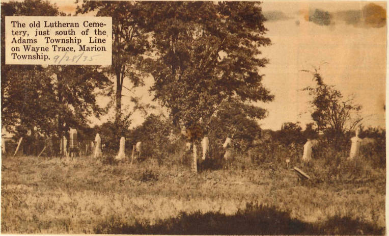
Earliest date April 1826 - 1868. No longer in use. 3 Morton family members were buried here - indicated by a wrought iron fenced in area and stone foundation. N DNR Latitude 40.9303 Longitude 85.0567.
South side near 9330 Wayne Trace in the woods off the road, ½ mile west of Soest Emmanuel.
The church property was purchased on February 1, 1852 and recorded on February 11, 1852, Allen County Deed Record O, pages 624-625. The church records also began in 1852, and state that they changed from a Lutheran congregation to a Reformed-Lutheran congregation in 1872, when they split away from Emmanuel Lutheran, Soest, after merging with St. Paul Lutheran, Marion Township, to become Emmanuel Lutheran in 1871. The last recorded event in the church records was in 1907.
Not in use. IN DNR Latitude 41.0006 Longitude 85.0467.
South side of Thompson Road, on the south side of US 469. It is at the dead end of Thompson Road a half mile from the intersection of Marion Center Road and Thompson Road, about 500' off the road
See Poe Cemetery, the town and cemetery were originally named for William Essig who is buried here with his family. He donated land for the original church and cemetery. There is a badly eroded concrete memorial that originally contained words probably commemorating the family and their land donations. If anyone knows the original words on the stone or has a photograph please contact Stan Follis