Google maps are slow to load - wait for colored pins to show
View Allen County, Indiana Cemeteries in a larger map.
Click on the pink dot St. Joseph Township pin to see cemetery
names.
Bowers Cemetery
9101 Stellhorn Road, on northeast corner of Stellhorn and Wheelock Roads inside Fort Wayne city limits
On March 31, 2023 there were 6 confirmed northeast Indiana tornadoes including Tornado - 3 N NEW HAVEN, IN which struck the Bowers Cemetery in St. Joseph Township shown in the video below:
DAMAGE: A large part of the roof at Central Ministries has been blown off, pieces of the debris are scattered around the building.
Old trees are uprooted all around Bower’s Cemetery.
The cemetery was mentioned in a later Facebook discussion April 1, 2023 and may have been near the beginning of an EF-2, one of two tornadoes along IN-37 from Fort Wayne towards Harlan, Indiana.
The National Weather Service officially confirms two tornadoes in northeast Allen County Friday night. An EF-2 developed in northeast Fort Wayne and moved into Harlan with estimated peak winds of 120 mph. This first tornado stayed on the ground for 7.8 miles and was expected to have a maximum width of 400 yards. from FIRST ALERT: Two tornadoes confirmed in Friday night’s storms on 21AliveNews.com.
Our survey teams have confirmed 3 tornadoes from Friday night! - An EF-1 tornado was confirmed in Royal Center, IN - An EF-2 and an EF-0 were confirmed northeast of Fort Wayne, IN Additional surveys are ongoing and we will have another update tomorrow or Monday. Find out more here: https://nwschat.weather.gov/p.php...
...NWS DAMAGE SURVEY FOR 03/31/2023 TORNADO EVENT|... .OVERVIEW... A SQUALL LINE WITH MULTIPLE STRONG CIRCULATIONS PRODUCED SEVERAL TORNADOES FROM WESTERN THROUGH EASTERN INDIANA LATE FRIDAY EVENING. .NORTHEAST ALLEN COUNTY TORNADO 1... the EF2 tornado ESTIMATED PEAK WIND: 120 MPH PATH LENGTH /STATUTE/: 7.8617 MILES PATH WIDTH /MAXIMUM/: 400.0 YARDS
Tornado - 3 N NEW HAVEN, IN which struck the Bowers Cemetery is discussed with a map in the link in this post.
From the March 31st event, we have a total of 6 confirmed tornadoes - 2 in White County, IN , 1 in Cass County, IN, 2 in Allen County, IN, and 1 in Paulding County, OH. You can read more about each tornado and see photos of the damage at Summary of Severe Weather Friday March 31st, 2023.
8:30 PM ET Update: For those wondering, we had survey teams go out today in Grant/Wells counties in Indiana. We have an additional team lined up to go out tomorrow to Jay County, IN and Allen County, OH. We will share additional updates and add more info to our event webpage sometime tomorrow.
The photo below is from the NWS IWX Survey of the EF-2 tornado in northeast Allen County, IN near Harlan, IN.
We are thinking of those impacted by Friday night's severe weather and tornado outbreak. Not just in our forecast area, but to anyone impacted in the Midwest and Mid-Mississippi Valley. ❤️
Work continued Tuesday on cleaning up a cemetery that has been the final resting place for more than 3,000 people since the early 1800s after it was decimated by weekend tornadoes in northeast Allen County.https://t.co/ROmn5SdTOJ
Work continued Tuesday on cleaning up a cemetery that has been the final resting place for more than 3,000 people since the early 1800s after it was decimated by weekend storms in northeast Allen County. Tombstones and centuries-old trees litter Bowers Cemetery after two tornadoes tore through the area. The National Weather Service determined them to be an EF2, with 111 mph to 135 mph winds, and an EF0, with 65 mph to 85 mph winds. The extensive damage to the cemetery, at Wheelock and Stellhorn roads, surprised Ed Snyder, president of the Bowers Cemetery Board. Snyder said he didn’t even know the area had suffered bad weather until he woke up Saturday. “The devastation is so big, there’s no way we have the money for that,” Snyder said, adding that the cemetery’s 4-year-old board doesn’t have much more than $2,000 in its bank account to pay for regular maintenance. Copied from the article: 'More hands make less work': Community members band together to clean cemetery 'decimated' by tornado Corryn Brock in The Journal Gazette newspaper.
A total of eight tornadoes have been confirmed within the National Weather Service’s Northern Indiana forecasting area.
Photo shows Bowers Cemetery.
May 8, 2023 post: "Following the tornadoes that swept through the area last month, the Small Business Administration is offering disaster loans to residents of Allen and area surrounding counties.
Despite the name, these loans aren’t only available to small businesses, but also for homeowners, renters and non-profit organizations."
Although some of the photos show damaged grave markers at Bowers #Cemetery, please know that the striking thing is how few stones were damaged given the destruction of trees by the #tornado.
The volunteers have done tremendous work in cutting trees and removing debris. Our thanks to each and every person assisting.
The stone marking the site of my Great Uncle Perry Spencer's parents and sister was spared.
First stone photo shows engraving: Site of Bowers Chapel 1863-1892. In memory of James and Berniece Lewis and all who volunteer to maintain the cemetery
"If someone would die that already has a plot there, I don’t know what I’d tell their relatives, because there’s no way we can get in there," Ed Snyder said. Now, he's hoping to organize a major volunteer effort to restore Bowers to its former glory.
Canterbury Green Golf Course 9th Hole Johnny Appleseed Memorial
There is a large memorial stone on the 9th hole of the golf course off Stonehedge Blvd. claiming Johnny Appleseed died and was buried there. Johnny Appleseed is most likely buried in Archer Cemetery across the parking lot from the Memorial Coliseum. This is discussed on our Johnny Appleseed page.
Crosier Cemetery
Formerly located on the west side of Wallen Road, east of the Old Auburn Road, where the Crosier House stood. Graves were moved when St. Joseph Hospital sold the land for housing developments. They are now in Section E, at the south-east corner of the Catholic Cemetery on Lake Avenue in Adams Township.
Catholic priests and brothers. Earliest date 1942. The Indiana DNR SHARD shows the former location of this cemetery on a PDF file. IN DNR Latitude 41.1606 Longitude 85.1158.
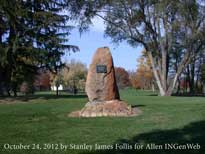
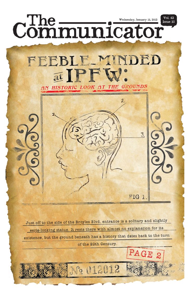
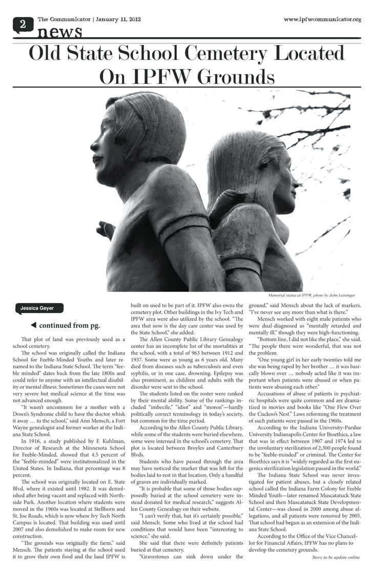
Fort Wayne State Hospital & Training Center
aka Indiana School for Feeble Minded Youth Cemetery
West side of St. Joe Road, between Broyles Drive and St. Joe Road at the north entrance of IPFW - Indiana Universty-Purdue University Fort Wayne campus. Referred to as God's Acre around the 15:50 and 48 minute mark of The Forgotten PBS documentary.
Google map barely shows the Indiana School for Feeble Minded Youth monument in the trees in a photo on Street View from St. Joe Road. The move of the Contenders Statue from the school and dedication at the cemetery is discussed first around the 1:17:10 mark in the original location in the center hallway of the community mall showing the plaque around the 1:17:25 mark, then the dedication at the 1:50:40 mark and again at the 1:55 minute mark for the December 2021 rededication shown in The Forgotten PBS documentary.
As a child, Jerry Henry remembers living in an old farmhouse that sat on more than a hundred acres along St. Joe Road and was the site of the Fort Wayne State Developmental Center.
His father, Jerome, was a social worker and worked for the school, which at that time was called the Indiana School for Feeble-Minded Youth. Henry, a local entrepreneur, says his father took the job with the state to help the family with living expenses. “We were so poor, we didn't have a car,” Henry says. By taking the job, the state provided a car, housing and a food allowance, he says.
But living on the school's site, which was owned by the state, provided some interesting memories for Henry, who was elementary school age at the time, and his siblings.
The Indiana School for Feeble-Minded Youth in Fort Wayne opened its doors in 1890 on East State Street, in an area that was, at the time, in the country. The school's campus included the Administration Building, cottages, a school, an industrial arts building, a hospital, and a gymnasium. The vocational arts were divided by gender, with men learning carpentry, agriculture, painting, upholstering and the making of mattresses, shoes and bricks, and the women learning the domestic arts of cleaning, cooking, canning, dressmaking, loom weaving and laundry. Residents came from all over the state. In 1931, the 1130 resident capacity facility housed 172, and had a waiting list of 200. That same year, the legislature changed the school's name to Fort Wayne State School.
In 1960, many residents moved to the new site at Stellhorn and St. Joe Roads, but some residents continued to live at the old school for about 20 years. After a number of years in which the State Street campus was inhabited by vagrants and rats, the Administration Building was demolished in 1982 to make way for North Side Park, which became Bob Arnold Northside Park. The Park Department saved a stone archway to leave as memorial to the former residents.
These mortality lists are taken from the Annual Reports of the Fort Wayne State School to the Governor, and cover the time period from November 1912 to June 1937. (ACPL call number GC 977.202 F77fmy.) After that time, the reports did not list the deaths. The report includes name, age, date and cause of death, and evaluation grade. Actual death records were created for each individual and are part of the Allen County Death Records. Microfiche copies of the Allen County Death Records to 1932 are held at The Genealogy Center of the Allen County Public Library. Later death records can be obtained from the State Vital Records Office. Among other information, death records could provide birthplace and parents' names, when known. Also provided are burial places. Some deceased residents were buried in their hometowns, others in various cemeteries in Allen County, including the institution's cemetery, located in Section 19 of St. Joseph Township, on the west side of St. Joe Road, between Broyles and Canterbury Boulevards. There is one large stone, dated 1901 to 1967, but the graves were never marked. It is probable that some of those bodies supposedly buried at the school cemetery were instead donated for medical research. Many deceased inmates, however, were buried in other cemeteries or returned to their hometowns for burial.
May
21, 2023 post with photos on True Fort Wayne Indiana History on Facebook. One comment They had planned to find the actual boundaries of the cemetery, but COVID interrupted their survey. See Jerry Henry 2020 interview above. Another May 22, 2023 post comment: I’m a retired surveyor and cemeteries have to be shown on our maps.
Our office prepared the survey when the Indiana and Purdue Foundations bought the land (going by memory, not that great) in the 1960’s and we showed the cemetery.
I remember working at the Riverbend Golf Course and there’s a cemetery also, small, you can see it when playing golf.
Indiana Surveyors are required to get”Continuing Education” and one year I took a class. The Parker Cemetery and the cemetery at I-69 and Coldwater were mentioned.
The First Death.— In 1830, William Matthews died and was buried in the cemetery near the Maumee settlement. There was then no cemetery in St. Joseph Township, and for four years thereafter the remains of deceased residents ol this township were taken to some of the neighboring burying grounds.
In 1834, Jesse Klinger donated a small tract of land on the St. Joseph River, to be used as a township' cemetery. It fell into disuse in later years, but its graves have never been disturbed. Peter Parker donated two acres of ground in 1846. The latter is now used as a burial place for the township. It is tastefully laid out and well cared for.
Jesse Klinger, a native of Pennsylvania, who settled on the Richardville reserve in 1829, and became a great favorite, and conspicuous for those kindly acts of neighborly kindness peculiar to the early days, was fairly embarked in making his farm, when he died in 1835, and was one of the first of those to be buried in the cemetery he had donated. His son, Samuel, born in 1830, was the first white native of the township.
In 1834, Mr. Klinger had given a small tract of laud on the St. Joseph river, to be used as a cemetery, burials having been made as far away as the Maumee settlement previous to that date. A year later, when his efforts toward competency were nearing deserved success, his health broke, and he himself was one of the first to be buried in the little "Acre." His wife returned to her Ohio home, with- her five-year-old son, Samuel, the first white child born in St. Joseph, only to lose him, also, a few years later.
The first St. Joseph pioneer to die was William Matthews, in 1830, before the establishment of a local burial place, he being laid in the Maumee settlement plot. The first cemetery, donated as has been said, by Jesse Klinger, 1834, was in use for twelve years, and was never disturbed; but a larger plot was given by Peter Parker in 1846 which then became the township cemetery.
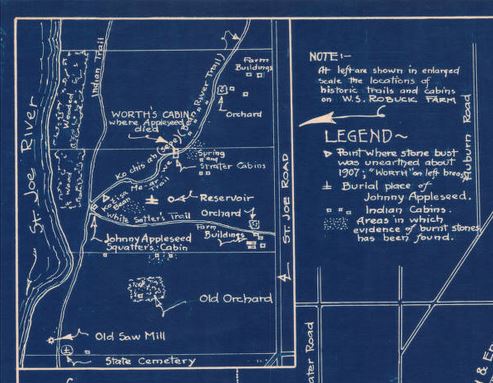
Earliest burial about 1834. No longer in use. According to old Plat Records in the Allen County Court House, there was a treaty between the United States and the Indians called The Treaty of the Wabash in 1826, giving certain lands to the Indians. The present-day golf course is on the before-mentioned land. Only 3 tombstones remain buried in the ground, one in German language. None for Mr. Klinger.
5800 St. Joseph Road on the southeast corner of the Saint Joe and Saint Joe Center Roads, contact information and maps are in a kiosk on the east side of cemetery. Parker Cemetery website has their history, photos, names, burial information, maps, and more at: www.parkercemeteryfw.com/. The original St. Joseph United Methodist Church was also located with the cemetery in an existing schoolhouse on the southeast corner of St. Joe Center Road, then moved to the northwest corner in 1863, then in 1957 moved down the road to the Reed Road and St. Joe Center Road intersection from the church history. Church history also says John Chapman, aka Johnny Appleseed attended early church meetings along the St. Joseph River which is about half a mile west of the cemetery and eventual church location when Johnny Appleseed died on March 11, 1845, his funeral was conducted by the Methodist circuit rider.
The first St. Joseph pioneer to die was William Matthews, in 1830, before the establishment of a local burial place, he being laid in the Maumee settlement plot. The first cemetery, donated as has been said, by Jesse Klinger, 1834, was in use for twelve years, and was never disturbed; but a larger plot was given by Peter Parker in 1846 which then became the township cemetery.
In 1846, Peter and Elizabeth Parker donated two acres for a township cemetery. Earliest date March 13, 1850. Still in use. Latitude 41.1331 Longitude 85.0986.
80 graves were moved to different locations in the cemetery in 2004 adding a new sign and fencing when Fort Wayne wanted to widen the two-lane roads at the intersection to four-lanes. See Road work may relocate century-old graves from newspaper articles on the Parker Cemetery website.
Earliest date 1871. Not in use. DAR site states "Named after Michael Pierre, an early French settler from Bettnig, France who was interred in this cemetery in 1871. At one time there was also a log cabin that served as a church for the Pierre Settlement on the site, which was known as St. Michael’s."
St. Michael's Catholic church, built on the farm of John Pierre in 1870, came third. This mission met the needs of a certain period, but with the trend of Catholic settlement in other directions, the building of St. Leo's at Leo, and of St. Vincent's near Academic, the church building has been abandoned and now stands empty and deserted by all but the graves of its early members, which still populate the little cemetery.