Maps of Allen County, Indiana

Maps can show useful information such as locations of rivers, creeks and various natural features. Maps can also show human built structures ranging from city and town limits, to canals, bridges, streets, roads, and various improvements. City directories can add timeline information on changing population numbers, streets and numbering, government location, schools, when buildings were built, and businesses opened.

Jump to: Additional Information, Allen County maps, Aerials, Copyright, Dave Rumsey, Sanborn maps, Other Sources, Trivia

December 14, 2015 post by the DAR Museum on Facebook:

Maps, like this one of VA over the fireplace mantle in the Virginia Period Room, often decorated walls in homes during the 1700s and early 1800s. Maps could be framed, but more commonly they were attached to wood rollers and hung from small brass rings. People most often hung maps in public spaces like a hallway, parlor, or dining room.

[ This is the Fry-Jefferson Map of Virginia first published in 1753 - this Jefferson was Thomas Jefferson's father.]

42 minute Allen County Info provides information on the iMap GIS Portal for Allen County residents briefly discussed on our Land Records page.

July 28, 2023 post by Allen County INfo on Facebook:

Last week the Allen County Commissioners recognized Dave Estes for an amazing accomplishment. Not only is Dave among the most elite in the country working in geographic information systems, or GIS, who have won a national SAG award, he is the only one in the world who has won it three times.

Allen County utilizes Esri's location intelligence software. Earlier in July, Dave traveled to the Esri User Conference where Allen County was selected from hundreds of thousands of users internationally for the coveted Special Achievement in GIS (SAG) Award.

Dave is the only full-time county employee managing the Allen County's GIS program. It is due to his innovative use of mapping and analytics technology that the county garnered the award.

Congratulations

, Dave Estes, for putting us on the map! (Pun intended)

To check out Allen County’s GIS map data, go to https://www.acimap.us/.

Pictured, left to right: Noah Miller and John Barnett - GIS Analysts for Resultant/DAI, Jack Dangermond – President and co-Founder of Esri, and Dave Estes – GIS Coordinator Allen County Indiana

Populated Places

  1. Aboite Township: Dunfee
  2. Adams Township: Adams Station, New Haven
  3. Cedar Creek Township: Cedarville, Grabill, Hamilton, Hursh, Leo, Urbana
  4. Eel River Township: Potter Station
  5. Jackson Township: Baldwin, Edgerton, Townley
  6. Jefferson Township: Besancon, Maples, Tillman, Zulu
  7. Lafayette Township: Aboite, Aboite Station, Nine Mile, Zanesville
  8. Lake Township: Arcola, Hadley
  9. Madison Township: Boston Corner, Centreville, Hoagland, Massilon
  10. Marion Township: Hessen Cassel, Middletown, Poe, Williamsport
  11. Maumee Township: Bluecast, Edwardsville, Woodburn
  12. Milan Township: Fairport, Gar Creek, Milan Center
  13. Monroe Township: Dixon (OH), East Liberty, Monroeville
  14. Perry Township: Carrolls, Huntertown, Hunterville, Royville
  15. Pleasant Township: Sheldon, Yoder
  16. St. Joseph Township: History of Townships
  17. Scipio Township: none
  18. Springfield Township: Cuba, Halls Corners, Harlan, Maysville
  19. Washington Township: Academie, Wallen
  20. Wayne Township: Fort Wayne, Kekionga, Lewisburg, South Wayne, Waynedale
Back to top

Allen County, Indiana Maps Chronologically

  1. Maps at Fort Wayne Community Development show all kinds of information from Annexation History to Census Data, Flood Plain, Neighborhood Association Quadrants, Political Boundaries, and more.
  2. iMap GIS Portal for Allen County residents, see video above, has maps for iMap Data Viewer, Engineering Viewer, Property Search, Election Board Viewer, Treasuer's Public Access, and City Parks, Recreation, and Trails Finder. If you go to Allen County iMap Data Viewer > Aerial > Historical Imagery Viewer > you can go back to aerial photos from 1938 through 2018 and Zoom through 14 different years of photos showing changes over time.
    1. Aerial Photographs and Maps

    2. Aerial photos ranging from the 1930's to the 1970's for various Indiana counties are online at AERIAL PHOTOGRAPHS AND HISTORIC MAPS at the Indiana Archives and Records Administration.
    3. IHAPI Overview states The Indiana Geological and Water Survey (IGWS) has created the "Indiana Historical Aerial Photo Index" (IHAPI) interactive map to facilitate the identification and retrieval of historical aerial photographs. It is at IGS Indiana Geological & Water Survey at Indiana University.
      IHAPI Map
    4. We have added 2014 aerial imagery. The entire state of #Indiana is covered. View of the #UniversityofIndiana located in #BloomingtonIndiana https://t.co/FTFGEfrFd9

      Posted by HistoricAerials.com on Monday, March 12, 2018

      March 12, 2018post by HistoricAerials.com on Facebook:

      We have added 2014 aerial imagery. The entire state of #Indiana is covered. View of the #UniversityofIndiana located in #BloomingtonIndiana

      Historic Aerials (Indiana) [ The Largest Database of United States Historic Aerial Imagery ]

    5. Indiana at Vintage Aerial claims 1,125,379 aerial photos available for Indiana. Select a county from the list or map to start searching. Allen County has 1,537 rolls of film for Allen County. That's about 54,296 photos in their Film Roll Index with 36 images each roll taken since 1965. See the video Vintage Aerial: Historic Photography of Rural U.S. Farms and Homesteads Dec 15, 2022 by Allen County Public Library on YouTube also on the Aerial Photographers section of our Photograph page with a few more aerial photographers.
  3. Allen County, Indiana - Townships Map interactive Google Maps at RandyMajors.org.
  4. Allen County Maps available at the Indiana State Library Map Collection.

    September 14, 2022 post by SAVI on Facebook:

    Have you seen the Indiana State Library’s digitized historical map collection? There are lots of great maps of Indiana back to 1792 and Marion County maps back to 1831. This image is from the 1831 plan. Notice Courthouse Square in the current location of the City County Building. Indiana State Library Map Collection

  5. 1778 high definition zoomable map titled A new map of the western parts of Virginia, Pennsylvania, Maryland, and North Carolina; comprehending the River Ohio, and all the rivers, which fall into it; part of the River Mississippi, the whole of the Illinois River, Lake Erie; part of the Lakes Huron, Michigan &c. and all the country bordering on these lakes and rivers, at The Library of Congress
  6. Allen County Plat Books (Countywide and Published for Public Distribution) and their Locations in the Genealogy Center is a list of maps from 1855 to the present available at the The Genealogy Center at the Allen County Public Library in Fort Wayne, Indiana.
  7. History Center Digital Collection on the mDON mastodon Digital Object Network has many useful collections including Fort Wayne (Ind.) -- Maps, Streets -- Indiana -- Fort Wayne -- Maps, and Railroads--Indiana--Fort Wayne--Maps.
  8. Kekionga, 1697-1824 at ACGSI.org
  9. Indiana Fort Wayne : ms. map of Fort Wayne said to have been made on July 18, 1795, for General Anthony Wayne at the The Library of Congress. The Notes states: the first American post, built in 1794 and named for Anthony Wayne after his victory at Fallen Timbers, was located across the St. Marys from the old Miami village of Kekionga and the remains of old Fort Miami, at the present intersection of Clay and Berry streets"--Ency. of Historic Forts, p. 281-282. This was drawn about nine months after Anthony Wayne built his fort at the NW corner of today's Clay and Berry Streets according to Randy Harter, Fort Wayne historian and authorcomment to the same photo posted September 18, 2017 on You are positively from Fort Wayne, if you remember... Archived group only visible to existing members on Facebook.
  10. A Map of Fort Wayne
    1812 Era Map of Fort Wayne, Allen County, Indiana at the The Genealogy Center at the Allen County Public Library in Fort Wayne, Indiana. The same interactive map is online at David Rumsey Map Collection, Indiana University Image Collections Online Indiana Historic Maps, and Curtis Wright Maps. Was discussed March 24, 2022 on True Fort Wayne Indiana History on Facebook.
  11. June 9, 2022 post by Indiana Archives and Records Administration on Facebook:

    In 1816 mapmaker John Melish initiated a project to produce a map for each state and territory in the Union. The Indiana map was the first one that Melish published in 1817. This map shows how southern Indiana was the first to be settled. The misplacement of Lake Michigan caused confusion and contention for quite some time. This eventually resulted in the Toledo War between Michigan and Ohio, the only military conflict between two U.S. states outside of the Civil War.

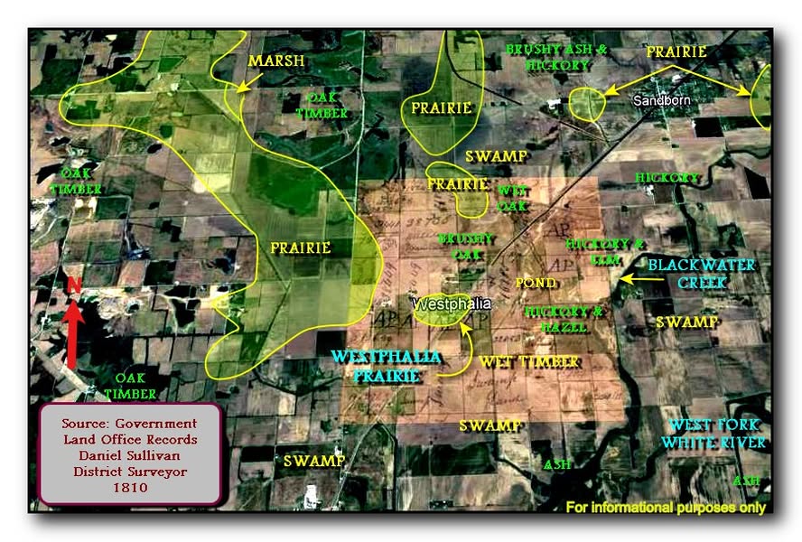
    Three settlement patterns in early Indiana - South 1790, Middle 1800-1830s, and North 1840s-1850s.

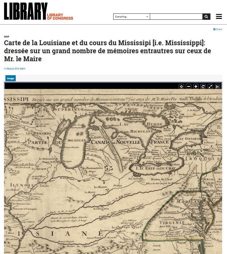
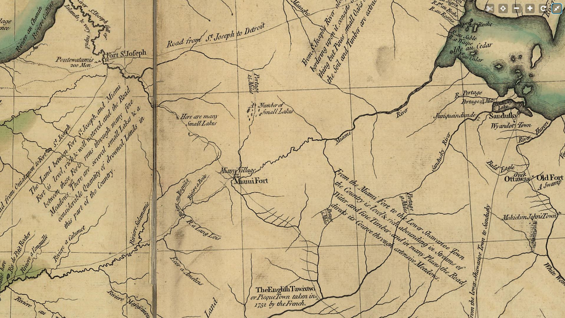
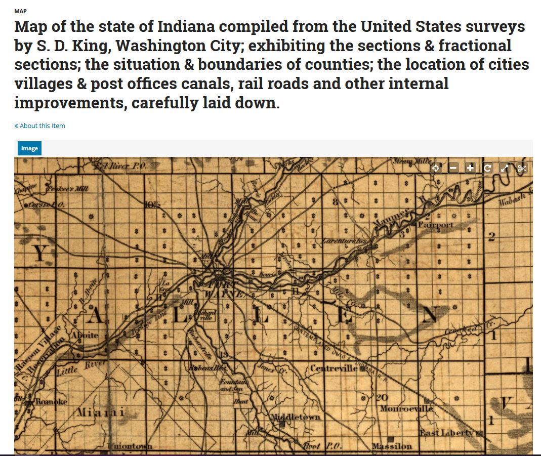
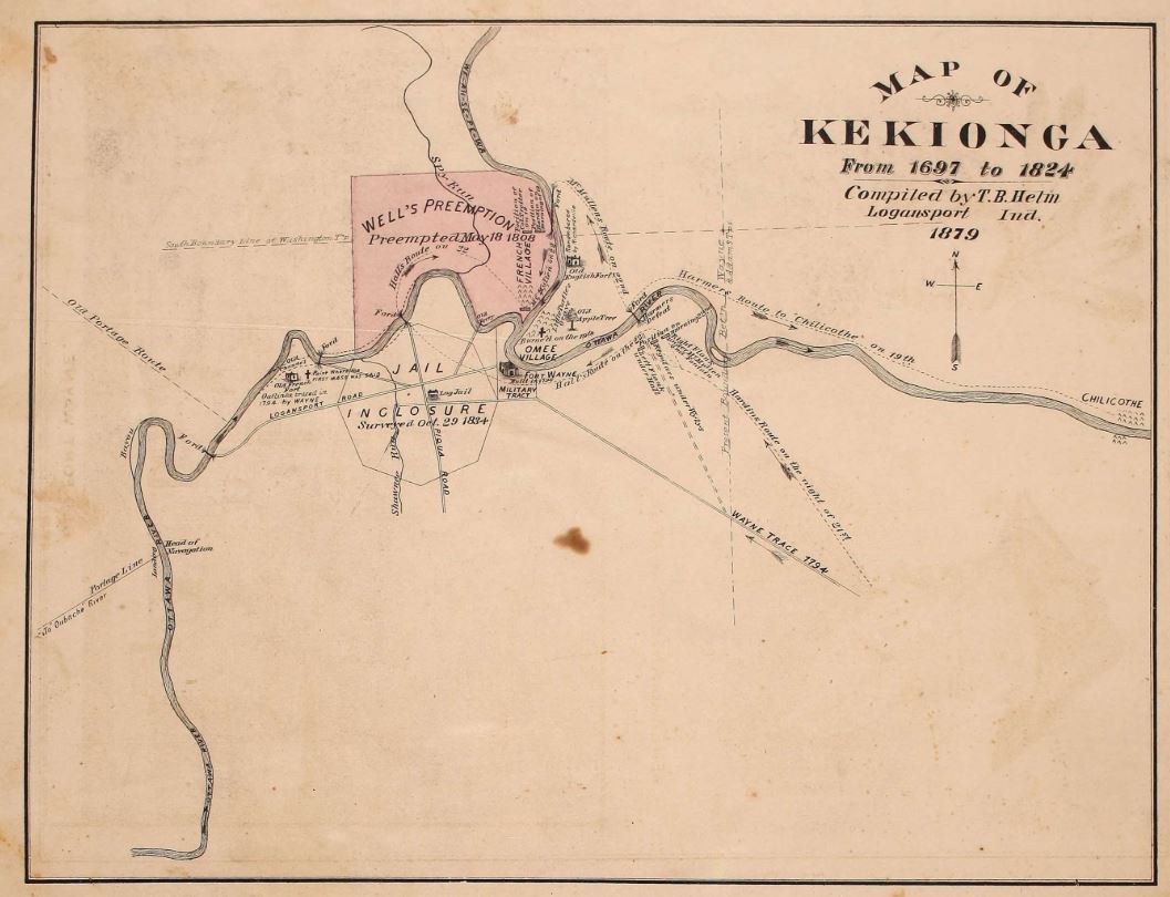
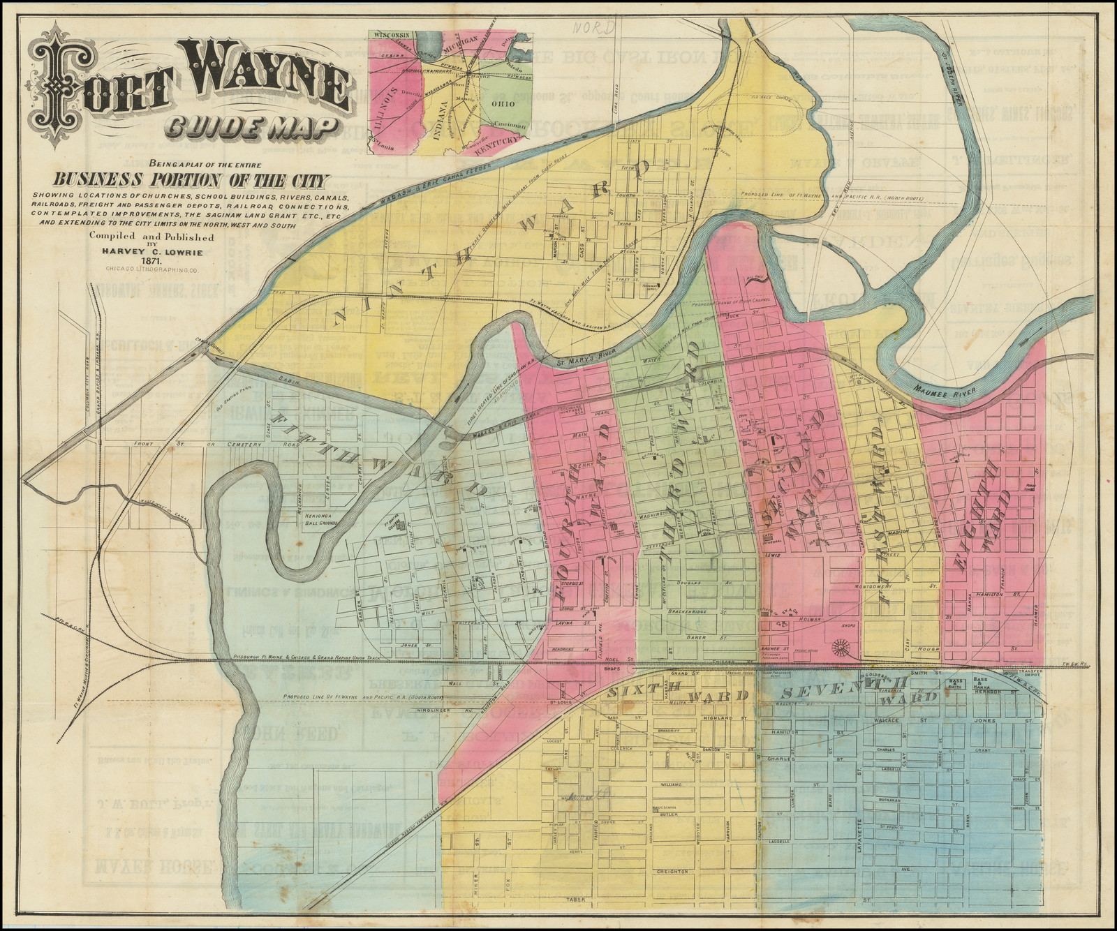
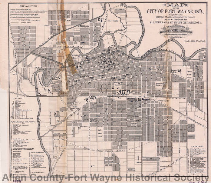
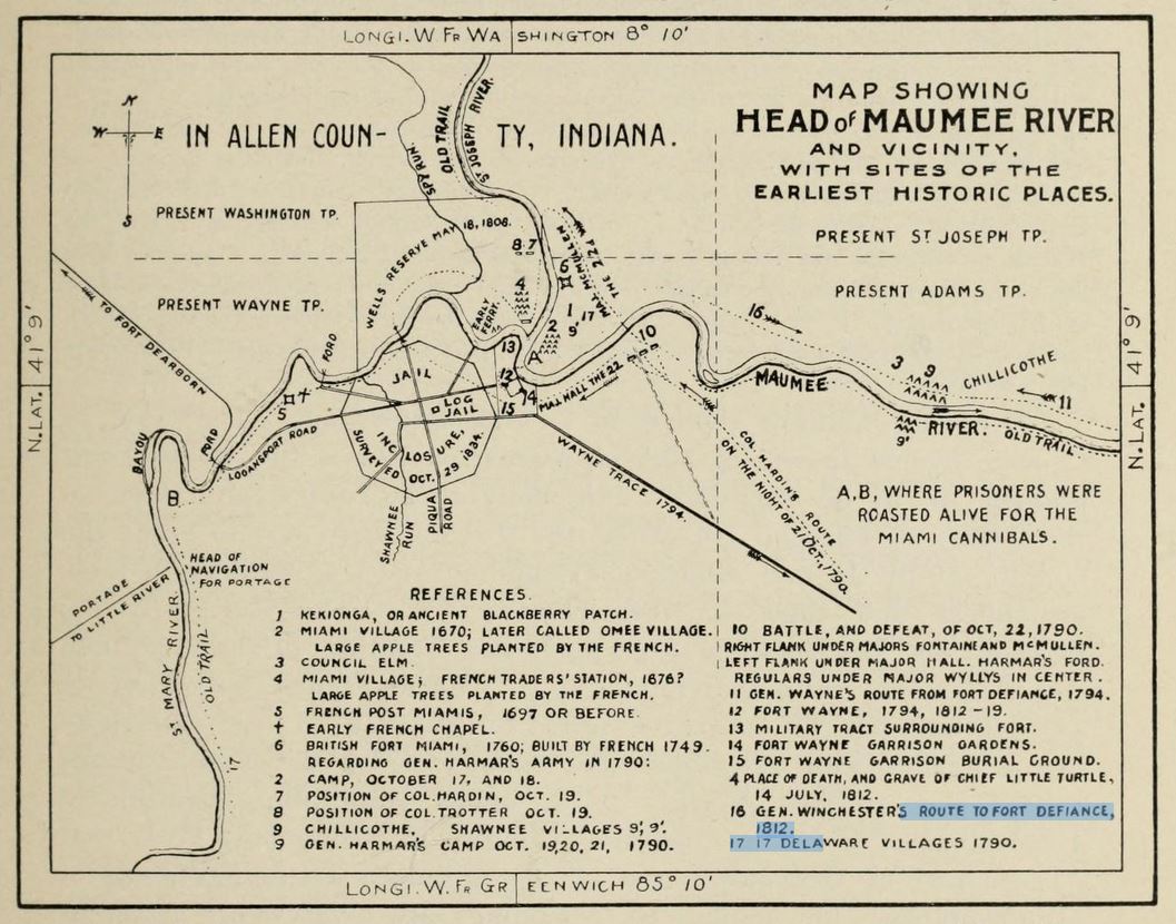
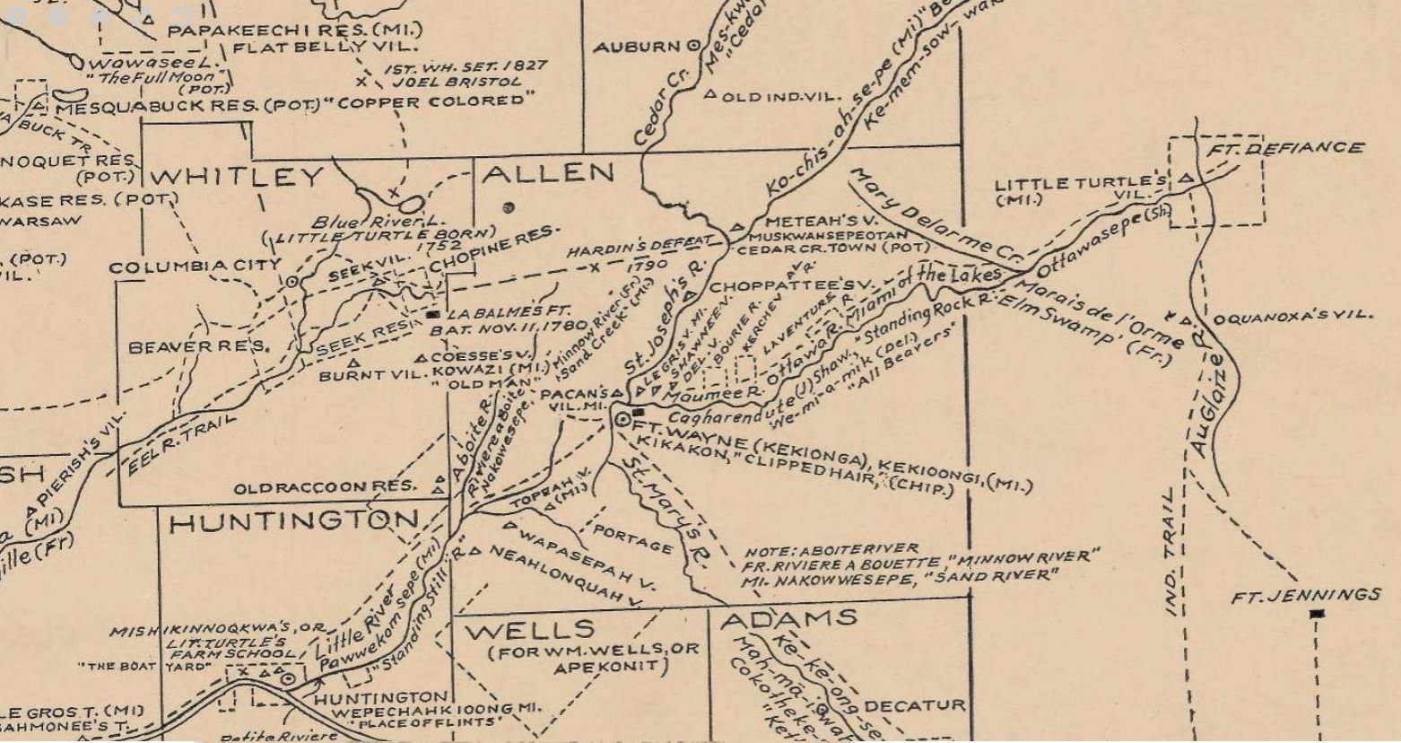
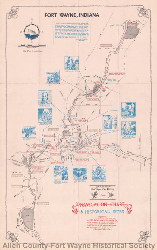
    French explorers and fur traders were in Kekionga the Miami Indian village area before Anthony Wayne built Fort Wayne in 1794. The French built two forts beginning in 1722 before George Washington sent troops to eventually build three of the last five forts in what is now Fort Wayne in Allen County, Indiana. Many Pennsylvania German's came into Allen County leading to Fort Wayne becoming a most German town by the 1890s with many German Swiss Amish still living in rural Allen County.

    November 16, 2023 post by the Hancock County Historical Society on Facebook:

    Did you know?...

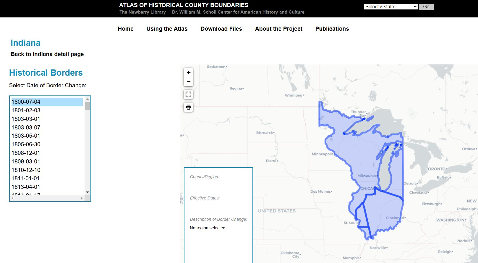
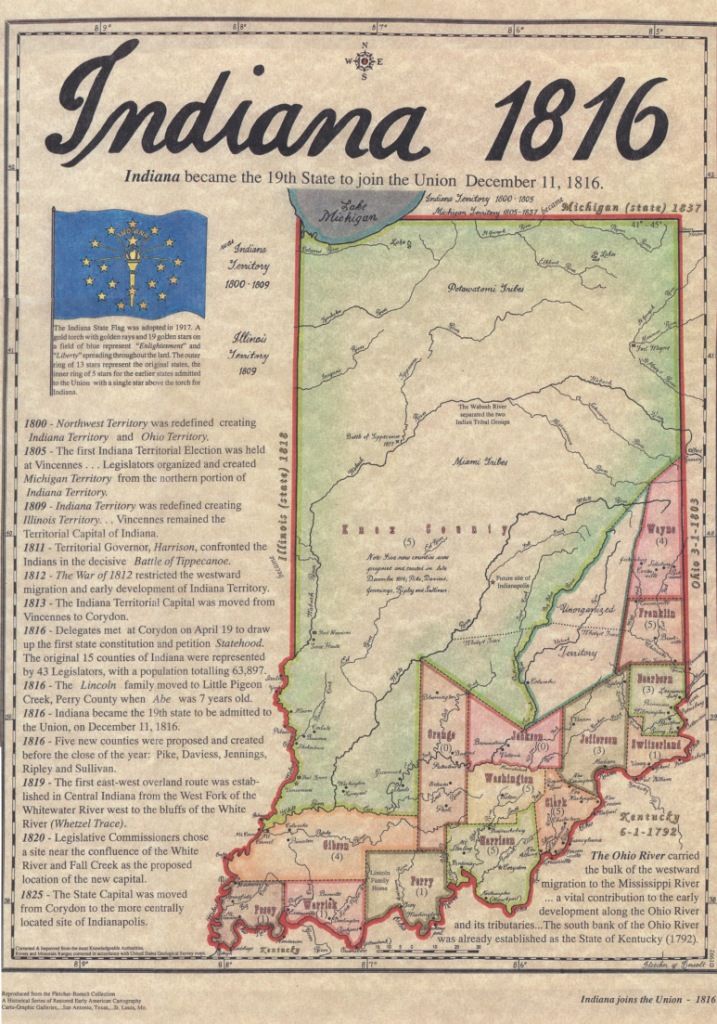
    Indiana, unlike other states, was settled in a South to North pattern rather than an East to West. This is an 1817 map of Indiana. One year after the state was granted statehood. You can see that most of the population is firmly established in the south.

    There are actually three different cultural areas to the state depending on the people who settled the area and when they arrived.

    The southern portion of Indiana was settled first when the Northwest Territory was opened up for settlement in 1790. The Ohio River along the southern border of the state is what encouraged this south to north settlement pattern.

    The southern part of Indiana was settled primarily from people from the south...Kentucky, Tennessee, North Carolina and Virginia. This is where you will see a pre-ponderance of Southern Baptists, Methodists and some Quakers. These people tend to eat more traditional southern food...grits, cornbread, bacon, fried chicken and whiskey.

    Indiana is known as the most southern of northern states.

    The middle of Indiana was settled in the early 1800s up through the early 1830s. Indianapolis would become the state capitol in 1825. While there is some overlap of southern culture in Central Indiana, many of Central Indiana settlers were originally from the Mid-Atlantic states...Pennsylvania, New York, Maryland and neighboring Ohio.

    There is a large Quaker population from Pennsylvania in this group. There are many Roman Catholics in this group and Lutherans. These folks tend to prefer the Mid-Atlantic diet, which has some heavy German influence. They prefer hamburger, tenderloin, wurst and sausage. They also like fish if it is available. Scrapple comes from PA. Sugar cream pie is a Quaker invention.

    The northern part of Indiana was settled last in the 1840s and 50s. The Potawatomi, the Shawnee and the Miami were some of the last American Indian tribes to leave the state. The Potawatomi were forced out on the Trail of Death.

    Also, northern Indiana was swampy, and the area needed to be drained before much settlement could happen.

    Indiana's Pioneer time period technically ends around 1850 when we see population leaving the state to go out west during the Gold Rush of 1849. However, the last of northern Indiana was still being settled even then.

    The folks who settled northern Indiana are your east coast people. They are from Rhode Island, Massachusetts, Connecticut, and from nearby Wisconsin and Michigan. These people tend to be Anglicans or Episcopalians or Presbyterians. There are many Scandinavian people in this group. They engage in the dairy business, so lots of cheese making. Apple and fruit orchards are more prevalent. Johnny Appleseed, a Massachusettes native, died in Fort Wayne. These people eat a lot of boiled foods. Pot roast is popular as are a variety of beans and lentils. Cider making is popular in northern Indiana.

    You can hear the differences in speech too.

    The people in southern Indiana have a more southern drawl. Central Indiana is home to the Hoosier dialect, where everyone "warshes" (with an R) their clothes. Northern Indiana has a more clipped speech like those who live in Da Region.

    While there can be a mixture of all of these cultures even within the three regions, there still tends to be a preponderance of an "established cultural norm" due to our pioneer settlement pattern. These norms ring true even today...200+ years after the founding of our state.

    Brigette Cook Jones

    HCHS Board Member and

    Past President

  12. November 24, 2023 post shared by Military History of Fort Wayne on Facebook:

    Tim J Fellure post November 24, 2023 to LIVING HISTORY IN THE WABASH COUNTRY

    Interesting map showing the route to the Battle of Tippecanoe and the route to the Battle of Wildcat Creek or Spurs Defeat.

    The Facebook map Indiana Country in the War of 1812 shown above is from page 27 in the book Indiana Country in the War of 1812 Indiana, "Hoosier State" : new historical atlas of Indiana, economic, social, political, for schools and libraries, business and industry in the Indiana Series in Two Parts; Volume I History and Government and Volume II The Historical Atlas by Olin Dee Morrison, History Department, Ohio University. 1958, E. M. Morrison, 152 Congress St., Athens, Ohio, USA at HathiTrust.org.

  13. Indiana State map 1819 - In 1816 mapmaker John Melish initiated a project to produce a map for each state and territory then in the Union. The Indiana map was the first one that Melish published in 1817. It was also the first map of Indiana produced by anyone. Rapid arrival of white settlers in the state led Melish to revise the map soon thereafter. The revised version is the one shown here. The map clearly shows that the pattern of settlement in Indiana was from south to north. The map also includes the township and range system, county names and boundaries at the time, Indian treaty lines and Native American villages, the major white settlements, rivers and creeks, trails and roads, forts, portages between rivers, and springs. Copied from Indiana State Map, 1819 at Maps in the Indiana Historical Society Collections
    1819 Indiana map
    Indiana Historical Society Collections map
  14. 1819 Ohio and Indiana zoomable map before northern Indiana had been divided into counties. Philadelphia : engraved & published by H.S. Tanner, [1819] at the The Library of Congress.
  15. Allen County Development Map, 1823-1835 at ACGSI.org.
  16. 1827 Indiana Map on our 1820s Timeline and Indians page.
  17. 1846 Map of Allen County
    1846 Map of Allen County map
      1846 Map of Allen County This map is a hand-drawn map showing Allen County, Indiana in 1846. The map shows townships, some settlements and tribal reservations. At the Indiana State Library Map Collection.
    Also on our 1840 Timeline and Indian page.
  18. Fort Wayne, panorama, 1857 at The Genealogy Center at the Allen County Public Library in Fort Wayne, Indiana
  19. Map of Allen County, Indiana, 1860 at The Genealogy Center at the Allen County Public Library in Fort Wayne, Indiana
  20. Bird's eye view of the city of Fort Wayne, Indiana 1868 at the The Library of Congress
  21. 1875 zoomable Allen County, Indiana map
    1875 - zoomable Map of Allen County, Indiana, Item ID ISL_IND_MapL_AllenCo_1875, Description:This 1875 detailed map of Allen County, Indiana, was drawn by Samuel Morrison and include railroads, churches, schools, and canals. at the Indiana State Library Digital Collection.
  22. Map of Allen County, Indiana - DPLA - 94c624e68b22ebf21d1d555c96613453
    1875 - zoomable Map of Allen County, Indiana . Description: This 1875 detailed map of Allen County, Indiana, was drawn by Samuel Morrison and include railroads, churches, schools, and canals. This file was contributed to Wikimedia Commons by Indiana State Library and Historical Bureau as part of a cooperation project. The donation was facilitated by the Digital Public Library of America, via its partner Indiana Memory. At Wikimedia Commons.org.
  23. 1876 Map of Allen County Andrea A.T. Baskin, Forster and Company, from the Dave Rumsey Map Collection - with over 100,000 maps of the world
  24. 459 page Illustrated historical atlas of the state of Indiana by Andreas, A.T. (Alfred Theodore), 1839-1900 is in the Fort Wayne Area History Collection at the History Center Digital Collection on the mDON mastodon Digital Object Network.
  25. 1876 map of Fort Wayne with Cedarville, Sheldon (currently known as Yoder), Arcola and New Haven from the David Rumsey Collection, can zoom in for more details, move the navigator, and go to original source of this Creative Commons License map.
  26. 1876 Map of Auburn, De Kalb Co., Ind. (with) Harlan Maysville, Monroeville, Edwardsburg, Huntertown, Hamilton. Andreas, A. T. (Alfred Theodore), 1839-1900; Baskin, Forster and Company, 1876, Dave Rumsey Map Collection 
  27. Panoramic view of the city of Fort Wayne, Allen County, Indiana : 1880, looking south east by Ruger, A; Stoner, J. J; Beck & Pauli Publication date 1960 at Internet Archive and a cleaner more legible version at IndianaHistory.org.
  28. Allen County, 1880 at ACGSI.org
  29. Map of the City of Fort Wayne, Indiana Creator Goshorn, Date of Original 1885. Description Map of the schools, public buildings and factories and churches in Fort Wayne, Indiana. " Map compiled from the original records and corrected to date, by W.H. Goshorn for R.L. Polk && Co.'s Ft. Wayne City Directory". Map not dated; but date supplied by Allen County-Fort Wayne Historical Society. At History Center Digital Collection on the mDON mastodon Digital Object Network.
  30. 1895 US Atlas map
  31. R.L. Polk & Co's map of the city of Fort Wayne, Indiana, 1897 by R.L. Polk &Co Publication date 1897
  32. Standard atlas of Allen County, Indiana : including a plat book of the villages, cities and townships of the county ... patrons directory, reference business directory ... by Geo. A. Ogle & Co. cn, Publication date 1898 on Archive.org. The same map with zoomable individual pages, directories of names, and photos in the Illustrations at Indiana Allen County 1898 Geo. A. Ogle, 1898 at Historic Map Works.

  33. Plat Book of Allen County, Indiana by Lindemuth, C. Ross, Publication date 1900 at Internet Archive
  34. 1905 Geological map of Allen County showing sand and gravel deposits. Historic Indiana Maps at IUPUI
  35. 1907 Griswold's birdseye view of the city of Fort Wayne, Indiana indexed for ready reference. B. J. Griswold, (Bert Joseph), 1873-1927 at The Library of Congress, click the map to zoom in for more detail. Excellent map with indexed locations for seeing where things were in early 20th century Fort Wayne. See it and more on our 1900 Timeline.
  36. Griswold's birdseye view of the city of Fort Wayne, Indiana indexed for ready reference by Griswold, B. J. (Bert Joseph), 1873-1927; Hixon, W. W Publication date 1907 on Archive.org is the same as Libary of Congress version above in book form from the Allen County Public Library.
  37. 1907 Plat book of Allen County, Indiana, 45 pages, Allen County Map Co., published Fort Wayne, Ind. : Allen County Map Co., 1907. Images on the Library of Congress web site.
  38. 1907 Plat Book of Allen County, Indiana American Memory version
  39. Allen County, Indiana from 1907 to 2011 Library of Congress over 30 Historical maps
  40. Map of the city of Fort Wayne, Indiana by Fort Wayne (Ind.). City Engineer's Office; Published 1910
  41. 1914 map of towns on Rootsweb.com
  42. J.M.E. Riedel's new street number guide map of Fort Wayne

    1919 J.M.E. Riedel's new street number guide map of Fort Wayne really large zoomable map at Digital Commonwealth Massachusetts Collection Online. A similar zoomable lower resolution J.M.E. Riedel’s New Street Number Guide Map of Fort Wayne at the We Do History digital collection by the Indiana Historical Society was discussed February 5, 2023 on True Fort Wayne Indiana History on Facebook.

    One thing to keep in mind looking at old maps was what access was available at this time especially in regards to bridges around Fort Wayne due to having three rivers. Our Johnny Appleseed Newspapers page discusses the lack of a bridge over the St. Joseph River in Washington Township including a 1916 newspaper article asking for a bridge to built to provide access to the Archer Cemetery to allow maintenance of the cemetery.

  43. 1920 Plat Book of Allen County, Indiana Plat Books of Indiana Counties Vol. 1 at IUPUI, Allen County begins on page 20
  44. Map of Allen County, Indiana : roads by Darling, Orin M; Tonkel, William; Lindemuth, C. Ross; Publication date 1923; Collection allen_county; americana
  45. Map of the city of Fort Wayne, Indiana by Allen County (Ind.). Surveyor's Office; Published 1923; Collection allen_county; americana
  46. 1924 Atlas of Fort Wayne, Allen County, Indiana, 24 images, 79 pages, 19 plats, Randall, Frank M., published South Bend, Ind. : G.L. Hughes, 1924. Same book starts with the Cover page are images on the Library of Congress web site.
  47. February 6, 2023 post by Genealogy Center on Facebook:

    Check out this map of Fort Wayne's central business district in 1929! 📜 Do you recognize any of these businesses? View our digital map collection here: https://www.genealogycenter.info/fwacdb.php This map showing ground floor occupancy was prepared by Hilgeman and Schaaf Realtors, January 1929.

  48. 1930s map of Lincoln Tower downtown with more maps from Sanborn, of Pennsy RR and more in comments of February 7, 2017 discussion on You are positively from Fort Wayne, if you remember... Archived group only visible to existing members on Facebook.
  49. Fort Wayne Central Business District, 1929 at the Genealogy Center
  50. [Map of the city of Fort Wayne, Indiana] by Allen County (Ind.). Surveyor's Office; Published 1931
  51. 1932 A picture map of Indiana at Dave Rumsey Map Collection.
  52. 1935 Allen County Indiana showing property owners with county officials listed along the top at the Indiana State Library Map Collection on our 1935 Timeline.
  53. November 16, 2022 post by the Indiana Historical Society on Facebook:

    Happy National Indiana Day! We love to share Indiana history with the Hoosier public. Visit us in downtown Indianapolis to spend the day learning with us! https://indianahistory.org/ To celebrate our Hoosier state, below is a photo of a Tourist’s Pocket Map from 1839! What’s your favorite part about Indiana?

    Zoomable map: The Tourist's Pocket Map Of The State Of Indiana Exhibiting Its Internal Improvements Roads Distances &c. By J.H. Young. Philadelphia: Published by S. Augustus Mitchell. 1839. Entered ... 1835, by S. Augustus Mitchell ... Pennsylvania. Sold by Thomas, Cowperthwait & Co. No 253 Market Street. Engraved by J.H. Young & F. Dankworth. at DaveRumseyMapCollection. The legend on the top right of the map shows the population of Allen County from the 1830 census was 996 with only 343,031 in the state of Indiana which is a less than the population of Allen County today! The legend on the left gives Steam Boat Route times.

  54. Street Map of the City of Fort Wayne, Allen County, Indiana Creator Fort Wayne (Ind.). Office of the City Engineer Date of Original 1940-1949 at History Center Digital Collection on the mDON mastodon Digital Object Network.
  55. March 8, 2023 post by Historic Southern Indiana on Facebook:

    This Indiana tourism map shows a 1940s portrayal of dozens of Indiana landmarks. From the Indiana Historical Society Map Collection

  56. September 20, 2023post by Historic Southern Indiana on Facebook:

    What would you add to this vintage map of Indiana?

    Joan Hostetler Collection, Indiana Album. Published in 1947.

  57. Street map of the city of Fort Wayne, Allen County, Indiana by Fort Wayne (Ind.). Office of the City Engineer; Green, Edward; Published 1959 on Archive.org.
  58. Suburban and Rural Additions, 1960 with index of additions, streets, and maps at the The Genealogy Center at the Allen County Public Library in Fort Wayne, Indiana.
  59. 1964 Municipal Beach area

    Chart of navigation routes for Fort Wayne, Indiana established following the 1964 river cleanup program. Fort Wayne, Indiana, Navigation Chart & Historical Sites in the History Center Digital Collection on the mDON mastodon Digital Object Network.

  60. Indiana is on page 38-39 of the 206-page LIST OF CARTOGRAPHIC RECORDS OF THE GENERAL LAND OFFICE (Record Group 49) Compiled by Laura E. Kelsay The National Archives National Archives and Records Service General Services Administration Washington: 1964.
  61. 2000 era cartoon map of area businesses photos were posted August 9, 2017 on You are positively from Fort Wayne, if you remember... Archived group only visible to existing members on Facebook.
  62. Street Map of New Haven, Indiana, 1990s at The Genealogy Center at the Allen County Public Library in Fort Wayne, Indiana.
Back to top

Alphabetical Map Sources

  1. iMap Allen County, Indiana GIS Portal - modern digital map site a the Allen County government - see video above
  2. Allen County Maps at Indiana State Library
  3. Allen County, Indiana Township Layout at ACGSI.org
  4. Allen County, Indiana township map - at Indiana University
  5. Annual Report of the Bureau of American Ethnology to the Secretary of the Smithsonian Institution Eighteenth annual report 1896-1897 Indiana Indians CXXVI Map 19 page 595. See our Indians Native American page.
  6. Bird's eye view of the city of Fort Wayne, Indiana 1868. Drawn by A. Ruger at The Library of Congress.
  7. City of Fort Wayne Interactive map
  8. Indiana maps in the Dave Rumsey Map Collection
  9. Fort Wayne Community Development has a Maps page.
  10. Fort Wayne, Indiana, Street Map with Overlays undated map 1700-1999. Description: A street map of downtown Fort Wayne, Indiana from Archer Street to Jefferson Street and St Marys Avenue to Comparet Street. First overlay denotes early Fort Wayne settlements and historical sites. Second overlay denotes existing markers and proposed markers or interpretive devices. Not dated at History Center Digital Collection on the mDON mastodon Digital Object Network and Fort Wayne, Indiana, Street Map with Overlays at Indiana Memory digital library at IN.gov.
  11. Fort Wayne has periodic flooding of the 3 rivers. An online tool shows current river levels. Flooding forecasts to take on new look Online map depicts water’s reach, depth by Dan Stockman October 26, 2012 in The Journal Gazette newspaper. The National Weather Service has an Advanced Hydrologic Prediction Service.
  12. GIS Indiana - Indiana Geographic Information Office
  13. Milan Township historically significant structures on Wikipedia.
  14. INDOT - Indiana Department of Transportation Maps

    February 7, 2023 post by Indiana Department of Transportation: Northeast on Facebook:

    If you're looking to ditch your phone's GPS and go old school with a paper map, you can get one with one easy click. Just visit the map section on our website and print away! 🗺️: https://www.in.gov/indot/resources/maps/

  15. Indiana The Early Years Maps Broadsides at IN.gov.
  16. Indiana Maps has Apps & Resources - description: IndianaMap is maintained for the Indiana GIS Community by the Indiana Geographic Information Officer (GIO) in partnership with geoConvergence and the Indiana Geographic Information Council (IGIC).
  17. IndianaMap Viewer is maintained for the Indiana GIS Community as an app that makes your own map at IndianaMap.org.
  18. Indiana State Library Map Collection has links to Allen County showing a dozen images and all 92 county maps.Their Map Collection has 11,000 maps most are not online.
  19. National Register of Historic Places in Allen County, Indiana - 3 tabs State, Districts, Vacant
  20. The Newberry Library of Chicago Atlas of Historical County Boundaries went offline in July 2015 and in April 2017 They're Back by Judy G. Russell published April 11, 2017 on her The Legal Genealogist blog blog. See Indiana Historical Borders and Indiana Detail page.

    January 27, 2023 post by Pennsylvania Chapter - Palatines to America - German Genealogy Society on Facebook:
    ATLAS OF HISTORICAL COUNTY BOUNDARIES The Atlas of Historical County Boundaries is meant to be a resource for people seeking records of past events, and people trying to analyze, interpret and display county-based historical data like returns of elections and censuses, and for people working on state and local history projects. The special interests of those potential users range from history to demography, economics, genealogy, geography, law, and politics.
    The data used in the Atlas project is readily available to download to be consulted, reviewed, and reused for any lawful purpose, commercial or non-commercial, without licensing or permission fees to the library. Please note that some files may contain the original, out-of-date copyright license; these can be ignored. https://digital.newberry.org/ahcb/
    HOW TO USE THE ATLAS https://digital.newberry.org/ahcb/usingatlas.html

  21. Fort Wayne at Old Maps Online
  22. Sanborn Maps

    1. Sanborn Maps at the Indiana State Library
    2. Indiana Sanborn Maps Database Basics and a list Index by County on the Union List of Sanborn Maps at Indiana University says the maps were created by the Sanborn Fire Insurance company for business purposes as detailed building-by-building depictions of most urban areas useful for all kinds of research. See their Sanborn Fire Insurance Maps History page. They have maps for Arcola, Fort Wayne, Huntertown, Monroeville, New Haven and Woodburn.
    3. Indiana University stated on their page: For states other than Indiana, try Michigan State University's Links to Sanborn Sites, UC Berkeley's Union List of Sanborn & Other Fire Insurance Maps
    4. The Library of Congress Sanborn maps collection
      1. Library of Congress Sanborn map collection with four historic maps of Fort Wayne
      2. Sanborn Fire Insurance Map from Fort Wayne, Allen County, Indiana has links to Mar 1885, 1890, 1902, 1906 Central business district, 1918 Vol. 1 congest district, 1918 Feb 1951 Vol. 1A.67.028, and 1919 - Mar 1951 Vol. 2.
      3. Ever wondered what all the colors and symbols mean on a Sanborn fire insurance map? Check out our handy guide on interpreting Sanborn maps! Did you know they sometimes show wells and boilers? See their Interpreting Sanborn Maps from their LOCMaps Tweet September 12, 2023 on Twitter.
      4. Sanborn Fire Insurance Maps
      5. Introduction to the Sanborn Map Collection.
    5. How to Use Online Sanborn Maps for Genealogy by Diane Haddad on FamilyTreeMagazine.com.
    6. Sanborn Maps by Mark Meyer published March 26, 2013 on the History Center Notes & Queries blog- towards the end says In conjunction with Historical Information Gatherers, Inc., all the original [pre-1924] Sandborn maps for Indiana communities were scanned into an ISDP database and are available at the ISDP website. The Indiana Spatial Data Portal (ISDP) provides access to more than 25 terabytes of Indiana geospatial data including USGS Topographic Maps.
    7. Sanborn Maps Collection Items at The Library of Congress. See Sanborn Fire Insurance Maps Now Online blog published May 25, 2017 with 25,000 maps from the late 1880s through early 1960s increasing to 500,000 maps by 2020 for all 50 states! Introduction to the Collection, Locations, and Indiana locations.
    8. Sanborn Fire Insurance Maps for Genealogy by Lisa Cooke posted Sep 13, 2022 includes the video below:
    9. Sanborn Insurance Maps at Library of Congress premiered September 15, 2022 by Lisa Louise Cooke's Genealogy Gems on YouTube
      Discover Sanborn Fire Insurance maps for genealogy with Julie Stoner of the Geography and Map Division of the Library of Congress. Learn search strategies, how to download the Sanborn maps for free and hidden online resources!

    10. February 24, 2023 post by Indiana State Library on Facebook:

      The Indiana State Library's latest blog post has plenty of tips to help you get started in historical business research. Read more here: Get started in historical business research! #business #research #Indiana

    11. The Accidental Revelations of Sanborn Maps by Tanvi Misra published October 13, 2014 at CityLab.com.
    12. Geospatial Applications at The Library of Congress
  23. Using maps in genealogy research by Jamie Dunn, Genealogy Division supervisor, posted October 13, 2022 on Indiana State Library blog. Maps are an incredibly useful tool for genealogy and local history researchers. They can show insights into how people lived that are not readily apparent through other documentary sources. They can be used to help untangle research questions and show off your research in new ways. Maps are also fun to use in research; they are often colorful and provide a level of visual interest not often found in written documents.
  24. The Second Correction Line passes through northern Allen County, Indiana which accounts for the offset of the northern townships and the tiny Scipio Township. It can be seen by zooming in on this 1866 General Land Office map in the Dave Ramsey Collection of antique maps.
  25. A map of the old interurban lines in Allen County and a map of the canals to overlay onto current maps was a question posted October 14, 2022 on True Fort Wayne Indiana History on Facebook. The 1993 Tom Castaldi, local historianmap is on our Wabash & Eric Canal page. Commenters shared the Indiana Electric Railways --11/22/14 - Google My Maps, the IndianaMap The Place for Indiana Geospatial Information at IN.gov and the magazine American Heritage Trusted Writing on History, Travel, and American Culture Since 1949 with an online Archive(1949-Present).
  26. February 22, 2023 discussion of local streets on True Fort Wayne Indiana History on Facebook.
Back to top

Dave Rumsey Maps

California Map Society, 2022 Conference: David Rumsey Interview by David Rumsey Map uploaded Jul 6, 2022 on YouTube

David Rumsey is interviewed by Tom Paper, Vice President of the California Map Society. Tom talks with David about his early years and college, his first work experiences involving art and technology, his transition to real estate development and his current activities with the David Rumsey Center, Luna Imaging and Cartography Associates.

  1. Dave Rumsey Maps
  2. Indiana Maps over 450

February 11, 2023 post by David Rumsey Map Collection on Facebook:

The Rumsey maps online image database crossed over 120,000 items today. A milestone of sorts. 10 million map images downloaded since site opened in 1999. View link below for 500+ selections from the past 5 years of additions. https://www.davidrumsey.com/.../online-rumsey...

April 14, 2023 post by Internet Archive on Facebook:

Cartography lovers unite! The David Rumsey Map Collection is home to more than 100,000 historic maps, atlases, charts, and diagrams, dating from the 16th century to the modern day - https://mailchi.mp/archive.org/email-20230413rumseymaps

David Rumsey Map Collection at the Internet Archive has over 111,000 maps!

Description: The David Rumsey Map Collection was founded in 1985 and went online in 1999 at davidrumsey.com. The collection includes over 200,000 rare 16th through 21st century maps of the entire World and parts of the Universe. 115,000 maps and related items are available online and 60,000 of those have been georeferenced. Rumsey has been donating the physical map collection and the digital database made from it to the David Rumsey Map Center at Stanford Libraries since 2008. The map center opened in 2016.The online map collection is a searchable database that allows you to make your own journeys into spatial representations of the past. Here you can see the history of cartography through primary sources from the present to centuries past. In 2022 Rumsey gave the entire digital collection to the Internet Archive to preserve and make available in the Archive's online library.

August 31, 2023 post by the David Rumsey Map Collection on Facebook:

Our new Machines Reading Maps tool that allows searching Text on Maps is now live at davidrumsey.com 100 million words indexed on 57,000 maps. Users can correct any errors. See our Text On Maps Help Guide for detailed descriptions on using this exciting new feature.

September 18, 2023 post by David Rumsey Map Collection on Facebook:

An interview with David Rumsey appears this month in the Portolan, the journal of the Washington Map Society. John Hessler asks Rumsey how his collecting began and evolved over decades, turning a private obsession into a public good. Full PDF at

https://rumsey3.s3.amazonaws.com/RumseyInterviewHessler.pdf

Back to top

Additional Map Information

  1. 1846 Post Offices on Internet Archive United States Official Postal Guide
  2. American Panorama is an historical atlas of the United States for the twenty-first century. It combines cutting-edge research with innovative interactive mapping techniques, designed to appeal to anyone with an interest in American history or a love of maps. Several interesting maps on Canals, Migration of Enslaved People, Overland Trails, Redlining and Urban Renewal. Redlining was posted February 28, 2028 on True Fort Wayne Indiana History on Facebook
  3. Atlases of Indiana by county - over 450 maps and atlases at Historic Map Works
  4. April 5, 2017 Facebook post shows a black ink used by draftsmen when preparing maps on a cloth "paper" or "vellum". Hofer and Davis, Inc. Land Surveyors show a bottle of ink by THE ROBERTS NUMBERING MACHINE COMPANY out of Brooklyn, New York that you can inspect and even have your photo taken at Their Wall.
  5. Explore America’s History With These Richly Interactive MapsAmerican Panorama” delves into the social, political and economic movements that define this country by Maris Fessenden on Smithsonian Magazine. From a September 14, 2022 by Smithsonian Magazine on Facebook stating: The wealth of digital tools available to mapmakers today means that these stories have now evolved to take viewers into the past, show changes over time and serve as detailed sources of information.
  6. BLM Bureau of Land Management - How to Search Family History in BLM Records - Online Patent Searches - Automated Records - National Park Service Homestead Records.
  7. Digital Public Library of America Announces Partnership with David Rumsey Map Collection on Digital Public Library of America blog April 30, 2013. The 38,000 digital map and image collection focuses on rare 18th and 19th century maps of North and South America.
  8. Discussion of 1876 map February 20, 2017 on You are positively from Fort Wayne, if you remember... Archived group only visible to existing members on Facebook.
  9. Drive Time map to other cities on Our Story Made Here
  10. Early Indiana Trails and Surveys on Archive.org published 1919 by George R. Wilson- Indiana Historical Society Publications Vol. 6 No. 3.
  11. Gazetteer at USGS Geographic Names Information Services GNIS
  12. Indiana county boundary changes over time at the Atlas of Historical County Boundaries Project at The Newberry Library includes interactive maps, shapefiles, chronologies, and metadata for each State.
  13. Indiana County Maps and Altlases - FamilyHistory1010.com clicking years shows county boundary changes
  14. Indiana Historical County Boundaries - Newberry Library
  15. Indiana Historical Counties 1778 - 2000 on Newberry Library Atlas of Historical County Boundaries
  16. Northeast Indiana Township maps - Census 2000 IU Kelley School of Business
  17. IndianaMap.org - Indiana Map and Data Downloads for counties
  18. Indiana Map at QuickFacts from the U.S. Census
  19. Interactive Map of Indiana County Formation History at MapsOfUS.org shows county changes over time.
  20. Map of Indiana County Formations 1758-1932 on MapGeeks.org an interactive series of maps showing county changes over time.
  21. Maps of Indiana posted Feb. 13, 2016 on Archives of Hoosier History Live podcast on Saturdays, noon to 1 p.m. ET on WICR 88.7 FM introduction begins with: On a map created in 1778, the name "Indiana" appears for a region that later became part of West Virginia. Other maps from the late 1700s and early 1800s reflect border disputes between Michigan, Ohio, Illinois and the Hoosier state. A detail from the 1918 map How to Drive to Brown County Best Routes provides an early glimpse of roadways for auto travelers.During the early auto era, the first so-called "highway map" of Indiana may have been one distributed in 1919. A map of Indiana's gravel roads was produced in 1895, while a bicycle route map helped 1901 travelers. All of them will be among the historic maps we will explore when Nelson is joined in studio by two Indiana Historical Society staff members. Eric Mundell and Amy Vedra are co-authors of Mapping Indiana (IHS Press), a new book that features 107 of the more than 1,700 maps in the society's collections.
  22. maps in public domain #united+states #indiana at picryl.com
  23. Historical Topographic Maps - Preserving the Past - USGS has over 193,000 topographical maps that will eventually be online. As of July 2013 Indiana was NOT listed in their Progress since April 2012 pdf.
  24. Indiana State Library Map Collection part of Indiana State Library Digital Collection in their Map Collection.
  25. Maps in the Indiana Historical Society Collections About this collection Maps augment and complement information found in books and manuscript collections. They show expansion of settlement, document legal boundaries, highlight transportation networks, report geological findings and more, while at the same time they can be works of art themselves. This collection contains some of the maps in our holdings. At We Do History online digital collection by the Indiana Historical Society.
  26. The Easy Way to Add Maps to Your Family History Projects published April 24, 2011 on Eastman's Online Genealogy Newsletter - using the National Atlas.gov.
  27. Land Patent Searchat FamilySearch.org.
  28. NARA National Archives - Land Records Introduction and Links to Resources on Land Entry Case Files and Related Records
  29. Convert an Address to Latitude and Longitude discusses converting addresses to Latitude and Longitude for easy GPS use, published December 29, 2009 on Eastman's Online Genealogy Newsletter.
  30. Maps - Araphax Publishing shows original land purchasers on land patents from Federal Government using BLM maps and others
  31. Using Maps in Genealogy - USGS
  32. Maps - Vpike.com uses Google Street View and Maps in separate windows to view main highways and city streets
  33. Michigan Road commissioned in 1826 connected Madison on the Ohio River with Michigan City on Lake Michigan. Map of early roads and canals was posted May 8, 2016 on Facebook by Indiana Bicentennial Commission on Facebook.
  34. Post Offices by County United States Postal Service with some establishment dates
  35. TigerWeb US Census Bureau Geography Division has a demo video
  36. USGS Quad Topographic Features in Allen County at TopoZone
    1. Virtual Public Lecture Seriesarchived as videos online: monthly talks are intended for a general public audience that may not be familiar with the science being discussed. Our speakers are encouraged to thoroughly explain the subject matter being presented, and to define any words or terms that may be unfamiliar to those not having a background or familiarity with the material being presented.
    2. USGSalso has a Public Lecture Series channel on YouTube.
  37. The Wabash trade route in the development of the old Northwest (1958) - Benton, Elbert Jay, 1871-1946
  38. Link to Fort Wayne, Indiana images on What Was There. WhatWasThere Our goal is to crowdsource a photographic history of the world -- or at least any place covered by Google Maps. It's fun and it's free. Try it! Copied from their Facebook page: https://www.facebook.com/WhatWasThere/.

    August 31, 2022 post by Heritage Documentation Programs, NPS on Facebook:

    WhatWasThere's goal is to #crowdsource a photographic history of the world -- or at least any place covered by GoogleMaps -- allowing you to tour familiar streets to see how they appeared in the past. It's fun and it's free!

    http://www.whatwasthere.com/

  39. Where is that place? explains the USGS mapping service by Judy G. Russell published December 3, 2018 in The Legal Genealogist blog blog pointing out the value of the volunteer The National Map Corps.
    1. More on those place names… by Judy G. Russell published December 4, 2018 in The Legal Genealogist blog. Some more GNIS details.
Back to top

Copyright

  1. Research by Wilkin (2017) based on works in the HathiTrust Digital Library found that over 50% of works published in the U.S. between 1923 and 1964 were in the public domain due to lack of proper copyright renewal. An earlier work on the copyright renewal of Sanborn maps (Musser, 2014) found similar percentages while more recent research (Musser in press) indicates that, if Sanborn maps are excluded from consideration, the copyright renewal rate for maps published in the U.S. between 1923 and 1964 is less than 10%. Copied form MORE MAPS ARE IN THE PUBLIC DOMAIN THAN YOU THINK by Linda Musser.
  2. A Study of the Copyright Renewal Rate for Maps, Linda Musser, Fletcher L. Byrom Earth and Mineral Sciences Library, Penn State University, 105 Deike Building, University Park PA 16802 USA. Abstract: This study examines the copyright renewal of maps published in the United States from 1923 to 1950 and compares the results with a recent study of copyright renewals for books. Results indicate that, while the average copyright renewal rate for maps appears similar to that of books, the average was skewed higher by a single publisher whose renewal rate was much higher than average. With the data from that publisher excluded, the average copyright renewal rate dropped to 10%, meaning that a significant number of maps copyrighted in the United States in the first half of the 20th century are probably in the public domain due to lack of copyright renewal. This has implications for library map digitization projects, as much more content may be available for scanning and archiving than was previously thought.

Using Maps for Genealogy Research Nov 10, 2022 by Allen County Public Library on YouTube
This presentation will describe how maps in the collections of The New York Public Library and elsewhere can be used in genealogical research. We'll look at fire insurance maps and atlases, military and topographical maps, county maps and atlases, and other types of map to locate records, discover where our ancestors lived, and what their lives were like. Presented by Philip Sutton. Philip Sutton is a reference librarian at New York Public Library's Irma and Paul Milstein Division of United States History, Local History, and Genealogy, where he also teaches and writes about genealogy and building history research. Sutton is a visiting Assistant Professor at the Pratt Institute, where he teaches a class in Genealogy and Local History.

Map Trivia

Neat map showing country and state creation through time of the North American continent ...

Posted by National Genealogical Society on Monday, February 22, 2016

February 22, 2016 post by the National Genealogical Society on Facebook:

Neat map showing country and state creation through time of the North American continent ...

December 2, 2016 post by Vox on Facebook:

"All maps are wrong. I cut open a globe to show why."

Making accurate maps is mathematically impossible.

Cities In North America Replaced By Cities On The Same Latitude

Posted by Mapsome on Tuesday, March 1, 2022

March 1, 2022 post by Mapsome on Facebook:

Cities In North America Replaced By Cities On The Same Latitude

Back to top

Page updated: March 17, 2024